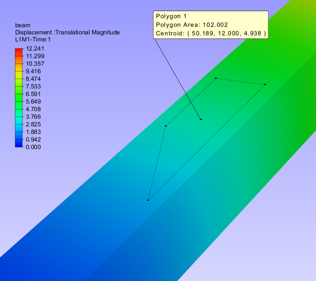
Polygon Area
User can define a polygon by points in a plane of the model and get the area value in a label. This helps user to compute the concentration of results in a particular zone.
Note
This function works well only for polygon defined in a plane.
Steps to measure a polygon area
Go to Tools | Measurements module
It expands with a submenu
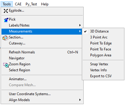
Select Polygon Area option. This enables mouse mode to pick points in the model.
Go to the viewer and click on the model to select points.
Select at least 3 points to define a polygon.
Right click or click on empty area to generate polygon area label.
Label displays Area and centroid of the polygon.
Make sure that all points selected are coplanar.